
Seward & Kenai Fjords
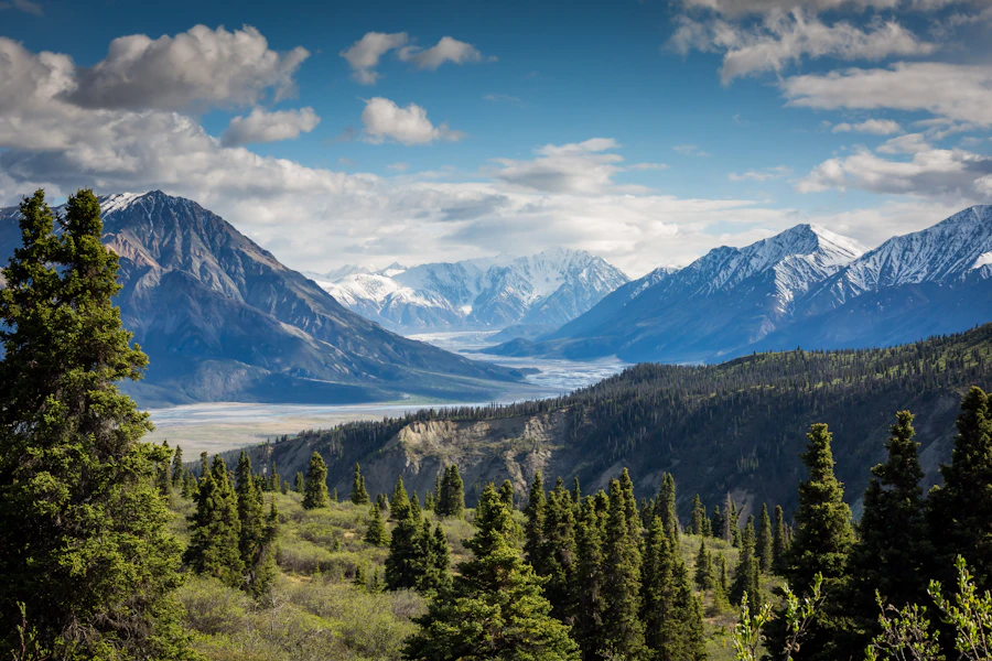
A working harbor town at the edge of a fjord-cut national park.

Alaska region guide
Icefields, salmon rivers and fjords — Alaska's playground, by road.
On the ground
Overview
The Kenai Peninsula hangs off the south side of Anchorage, bounded by Cook Inlet on the west and the Gulf of Alaska on the east. Its spine is the Kenai Mountains, and draped across their southern half is the Harding Icefield — roughly 700 square miles of ice that feeds nearly 40 glaciers, many of them flowing straight into the fjords of Kenai Fjords National Park.
What makes the Kenai unusual in Alaska is how reachable it is. Two paved highways cross it, the railroad runs to Seward, and towns like Homer, Soldotna and Cooper Landing have lodging, guides and charter fleets. You can watch tidewater glaciers calve in the morning and be standing in the Kenai River by evening.
People come for the fishing above all — the turquoise Kenai River and its tributary the Russian host some of the most famous salmon runs in the world, and Homer calls itself the halibut fishing capital of the world. But the hiking is just as strong, from the icefield overlooks above Seward to the multi-day Resurrection Pass Trail and the glacier lakes across Kachemak Bay.
Local guides
A working harbor town at the edge of a fjord-cut national park.

The end of the road, with glaciers across the bay and halibut below.

Cooper Landing and Soldotna — the heart of Kenai salmon country.

Alpine meadows, backcountry ski terrain and a gold-rush village.
Explore
Icefields, salmon rivers and fjords, all within a drive of Anchorage.
Icefields, salmon rivers and fjords — Alaska's playground, by road.
Icefields, salmon rivers and fjords — Alaska's playground, by road.
Icefields, salmon rivers and fjords — Alaska's playground, by road.
Explore
Ranges and icefields define this region's high country.
The Kenai Mountains run the length of the peninsula's eastern side, a continuation of the Chugach. They are steep, heavily glaciated and cut by deep valleys that hold lakes like Kenai, Skilak and Tustumena.
Access: Alpine ridges above dense spruce and hemlock forest, with brushy subalpine zones of alder and willow.
Truuli Peak (about 6,600 ft, highest on the peninsula) · Mount Alice · Mount Marathon (3,022 ft)
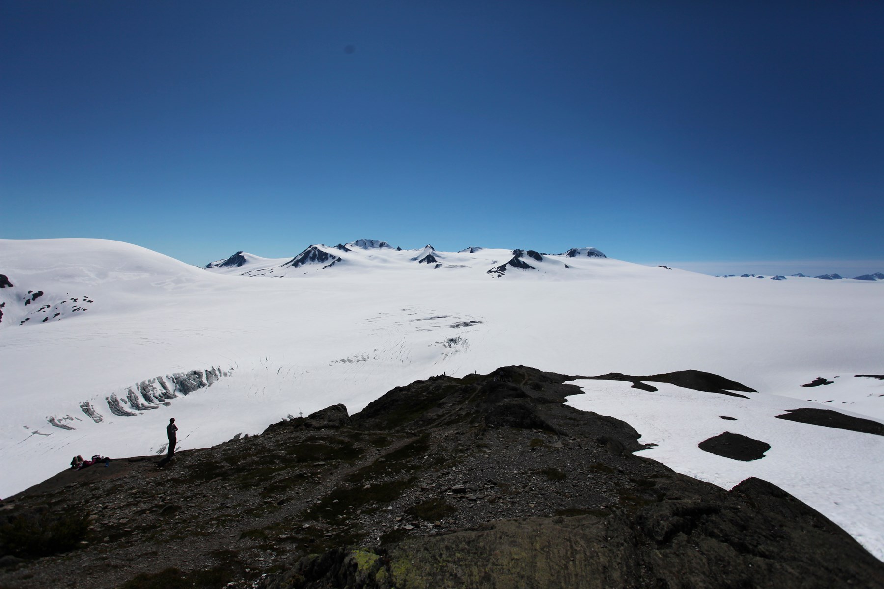
One of the largest icefields entirely within the United States, the Harding covers roughly 700 square miles of the Kenai Mountains and feeds nearly 40 glaciers, including Exit, Bear and Aialik glaciers.
Access: An undulating plateau of ice and snow, crevassed at its edges. Crossing it is an expedition requiring glacier travel skills.
Nunataks — isolated rock summits poking through the ice
Explore
Local state & national parks options. Check current availability and land-manager advice.
Seward & Kenai Fjords
Check the land manager's current visitor information before arranging travel.
Type: national park
Land manager: National Park Service
Permits: Confirm reservations, commercial operator permissions and backcountry requirements with the land manager.
Homer & Kachemak Bay
Check the land manager's current visitor information before arranging travel.
Type: state park
Land manager: Alaska State Parks
Permits: Confirm reservations, commercial operator permissions and backcountry requirements with the land manager.
Kenai & Russian Rivers
Check the land manager's current visitor information before arranging travel.
Type: refuge
Land manager: US Fish and Wildlife Service
Permits: Confirm reservations, commercial operator permissions and backcountry requirements with the land manager.
Turnagain Pass & Hope
Check the land manager's current visitor information before arranging travel.
Type: forest
Land manager: US Forest Service
Permits: Confirm reservations, commercial operator permissions and backcountry requirements with the land manager.
Content coming soon
Explore
Established trails and backcountry routes offer very different levels of commitment.
Climbs beside Exit Glacier to a view across the icefield. Snow lingers into July; bears are common.
Sampled NPS trail-map waypoints (feet), outbound from trail register; schematic, not navigation. NPS map lists 7.8 mi round trip from register; legacy 8.2 mi approach distance awaits verification.
Exit Glacier Nature Center, near Seward
Trail detailsShort, family-friendly walk to views of the glacier's toe; signs mark its retreat over the decades.
Exit Glacier Nature Center
Trail detailsClassic 3–5 day traverse with public-use cabins along the way; also popular with mountain bikers.
Hope (north) to Sterling Highway near Cooper Landing (south)
Trail detailsClimbs through forest to an alpine lake basin with big views of Resurrection Bay.
Lost Lake Trailhead, Mile 5 Seward Highway
Trail detailsFlat walk to an iceberg-dotted lake below Grewingk Glacier in Kachemak Bay State Park.
Water taxi from Homer to Glacier Spit or Rusty's Lagoon
Trail detailsExplore
Species, waters and approximate monthly run timing. Always check current fishing regulations and emergency orders.
Home of world-record kings, big sockeye and silver runs and trophy rainbows. King fishing is often restricted — check current emergency orders.
King (Chinook) salmon · Sockeye (red) salmon · Coho (silver) salmon · Pink salmon · Pacific halibut · Rainbow trout · Dolly Varden
River
Clear tributary of the Kenai near Cooper Landing; famous early (June) and late (July) sockeye runs.
King (Chinook) salmon · Sockeye (red) salmon · Coho (silver) salmon · Pink salmon · Pacific halibut · Rainbow trout · Dolly Varden
River
Smaller river south of Soldotna with king, sockeye and silver runs and a popular dipnet fishery.
King (Chinook) salmon · Sockeye (red) salmon · Coho (silver) salmon · Pink salmon · Pacific halibut · Rainbow trout · Dolly Varden
River
Large glacial lakes; trout and Dolly Varden near inlets and outlets.
King (Chinook) salmon · Sockeye (red) salmon · Coho (silver) salmon · Pink salmon · Pacific halibut · Rainbow trout · Dolly Varden
Lake
Halibut charters from the Homer Spit, plus saltwater kings and silvers.
King (Chinook) salmon · Sockeye (red) salmon · Coho (silver) salmon · Pink salmon · Pacific halibut · Rainbow trout · Dolly Varden
Saltwater
Halibut, rockfish, lingcod and silver salmon out of Seward.
King (Chinook) salmon · Sockeye (red) salmon · Coho (silver) salmon · Pink salmon · Pacific halibut · Rainbow trout · Dolly Varden
Saltwater
On the water
| Season | Jan | Feb | Mar | Apr | May | Jun | Jul | Aug | Sep | Oct | Nov | Dec |
|---|---|---|---|---|---|---|---|---|---|---|---|---|
| King / Chinook | ||||||||||||
| Sockeye / Red | ||||||||||||
| Coho / Silver | ||||||||||||
| Pink / Humpy (even years) | ||||||||||||
| Chum / Dog (localized) |
Approximate freshwater timing varies by river and year. Pink runs can vary with odd/even years. A run does not mean fishing is open; check current regulations and emergency orders.
A field companion
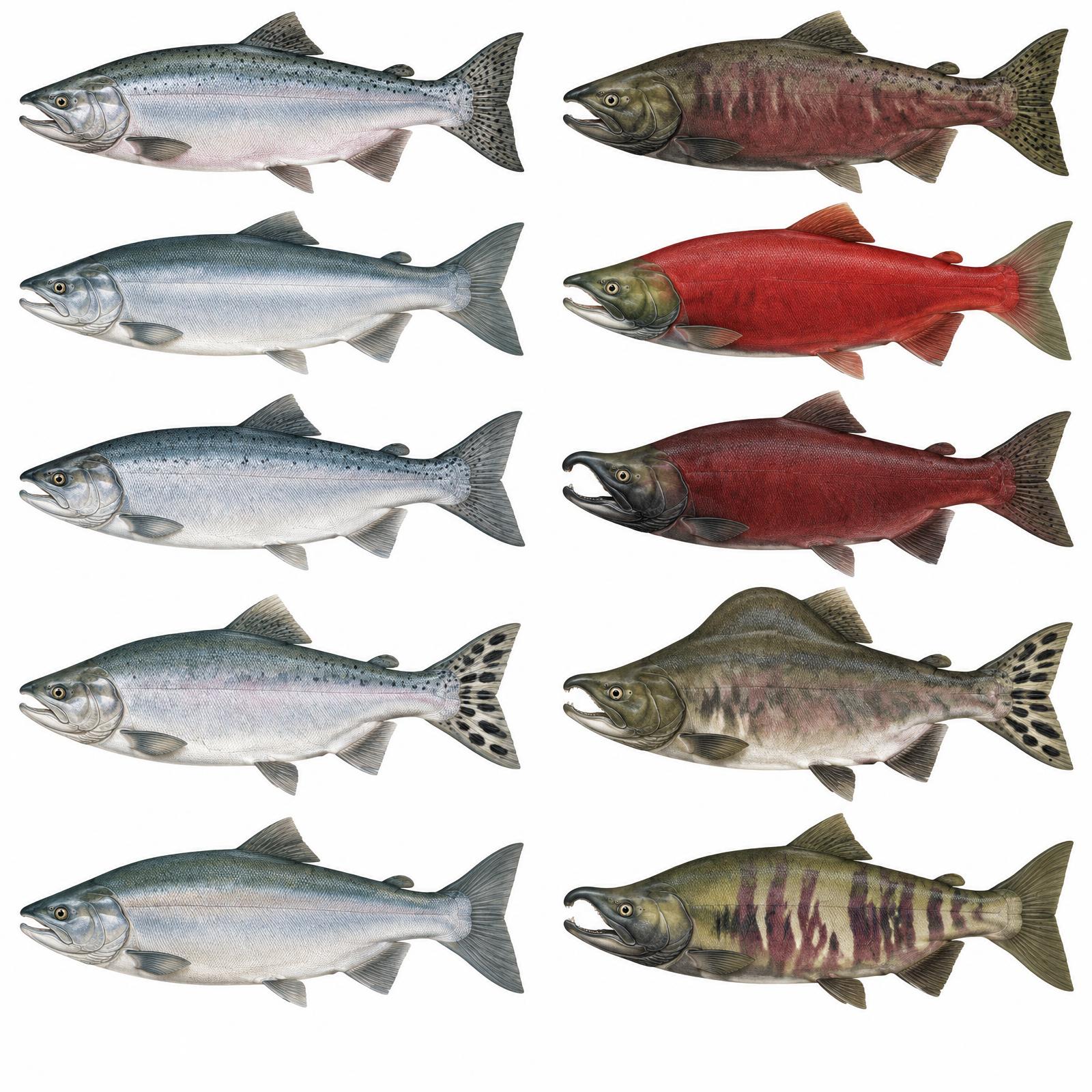
King
Usually 10–20 lb
Red
About 4–8 lb
Silver
Usually 8–12 lb
Humpy
Average 3.5–5 lb
Dog / Keta
About 6–12 lb
Illustrations are interpretive; identify fish by several traits together, not pupil shape alone. Adult sizes vary by stock. Official ADF&G identification chart
Current ADF&G sport-fishing regulations and emergency orders
Explore
Coastal mountains, river valleys and the lowland forests and wetlands of the Kenai National Wildlife Refuge.
Most big-game seasons run from August into the fall; moose generally late August to September. Antler restrictions and permit hunts are common on the Kenai.
Game management unit: 7 / 15
Nonresidents: Nonresidents hunting brown/grizzly bear, Dall sheep or mountain goat need a licensed Alaska guide or an eligible Alaska-resident relative; nonresident aliens require a guide for all big game. Check current permits, seasons and emergency orders.
Moose · Dall sheep · Mountain goat · Black bear · Brown bear (limited permits) · Caribou (small herds)
Seasons, permits and land restrictions change. Check current Alaska Department of Fish and Game regulations before planning a hunt.
Explore
Coastal and inland wildlife reward patient, responsible viewing.
Observe from a safe distance and respect feeding and travel routes.
Observe from a safe distance and respect feeding and travel routes.
Observe from a safe distance and respect feeding and travel routes.
Observe from a safe distance and respect feeding and travel routes.
Observe from a safe distance and respect feeding and travel routes.
Bear country
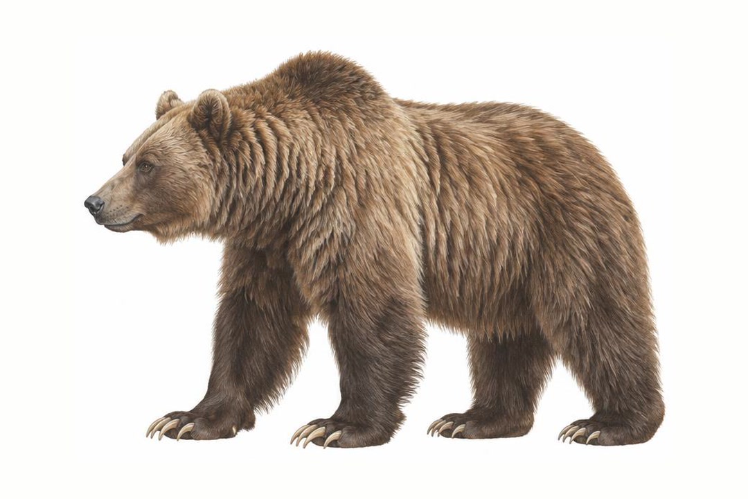
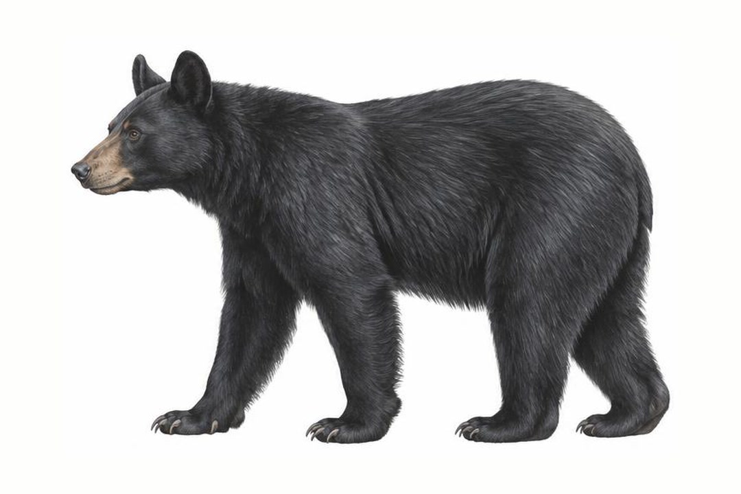
Both species vary in coat color. Never approach a bear to identify it. Stay alert, make noise in dense cover, give bears space, secure food and garbage, and never run. Carry accessible bear spray and know how to use it.
ADF&G bear safety guidanceExplore
Local four-wheel drive & backroads options. Check current availability and land-manager advice.
Seward & Kenai Fjords
Exit Glacier Road; seasonal snow closures.
Conditions: Verify seasonal openings, washouts and land permissions.
Vehicle: Check rental exclusions; do not enter uncertain water crossings.
Homer & Kachemak Bay
Homer roads; park across the bay has no road access.
Conditions: Verify seasonal openings, washouts and land permissions.
Vehicle: Check rental exclusions; do not enter uncertain water crossings.
Kenai & Russian Rivers
Skilak Lake Road gravel loop; confirm conditions.
Conditions: Verify seasonal openings, washouts and land permissions.
Vehicle: Check rental exclusions; do not enter uncertain water crossings.
Turnagain Pass & Hope
Hope Highway and designated forest roads; motorized trail restrictions apply.
Conditions: Verify seasonal openings, washouts and land permissions.
Vehicle: Check rental exclusions; do not enter uncertain water crossings.
Content coming soon
Explore
Local rafting & paddling options. Check current availability and land-manager advice.
Seward & Kenai Fjords
Resurrection Bay kayaking; weather and tide planning
Difficulty: Reach- and weather-dependent; obtain local advice
Season: Generally summer; verify water levels, ice and operator schedules
Homer & Kachemak Bay
Kachemak Bay kayaking; tidal crossings
Difficulty: Reach- and weather-dependent; obtain local advice
Season: Generally summer; verify water levels, ice and operator schedules
Kenai & Russian Rivers
Upper Kenai drift trips; choose reach and flows carefully
Difficulty: Reach- and weather-dependent; obtain local advice
Season: Generally summer; verify water levels, ice and operator schedules
Turnagain Pass & Hope
Sixmile Creek guided whitewater; advanced Class IV–V canyon sections
Difficulty: Reach- and weather-dependent; obtain local advice
Season: Generally summer; verify water levels, ice and operator schedules
Content coming soon
Explore
Local camping options. Check current availability and land-manager advice.
Seward & Kenai Fjords
Facilities and seasons vary; pack out waste and store food securely away from wildlife.
Homer & Kachemak Bay
Facilities and seasons vary; pack out waste and store food securely away from wildlife.
Kenai & Russian Rivers
Facilities and seasons vary; pack out waste and store food securely away from wildlife.
Turnagain Pass & Hope
Facilities and seasons vary; pack out waste and store food securely away from wildlife.
Content coming soon
Explore
Local other activities options. Check current availability and land-manager advice.
Seward & Kenai Fjords
Confirm availability directly, and respect community guidance and access permissions.
Homer & Kachemak Bay
Confirm availability directly, and respect community guidance and access permissions.
Kenai & Russian Rivers
Confirm availability directly, and respect community guidance and access permissions.
Turnagain Pass & Hope
Confirm availability directly, and respect community guidance and access permissions.
Skiing, dark days
Backcountry skiing
Spring corn snow
Shoulder season, quiet
Trails melting out, first halibut
Russian River sockeye, long days
Peak salmon & glacier cruises
Silvers & ripe berries
Fall colors, silvers, moose hunts
Rainy, quiet, fall trout
Early snow
Aurora on clear nights
Content coming soon
Through the year
| Season | Jan | Feb | Mar | Apr | May | Jun | Jul | Aug | Sep | Oct | Nov | Dec |
|---|---|---|---|---|---|---|---|---|---|---|---|---|
| Wildlife viewing | ||||||||||||
| Fishing | ||||||||||||
| Hiking | ||||||||||||
| Northern lights | ||||||||||||
| Midnight sun | ||||||||||||
| Winter sports |
Peak and shoulder planning windows; weather and conditions vary. Aurora requires darkness and clear skies. Southern Alaska has long summer days, not a true 24-hour midnight sun.
Explore
Getting there and around.
The Seward Highway runs 127 miles from Anchorage to Seward; the Sterling Highway branches west at Tern Lake to Cooper Landing, Soldotna and Homer.
The Alaska Railroad's Coastal Classic runs Anchorage–Seward daily in summer.
Short hops from Anchorage to Kenai (ENA) and Homer (HOM).
Homer and Soldotna are bases for flightseeing and bear-viewing trips across Cook Inlet.
Taxis from the Homer Spit cross Kachemak Bay to the state park, Halibut Cove and Seldovia; Seward taxis serve remote coves of Resurrection Bay.
Anchorage
road · About 2½–3 hours
Seward
Anchorage
railroad · About 4¼ hours; summer service
Seward
Homer
water taxi · About 30–60 minutes; landing varies
Kachemak Bay trails
Typical travel estimates, not a timetable. Check operators and allow time for weather.
Gallery