

Cultural site
Matanuska Colony Historic District
- Site type
- Historic site
- Cultures
- Matanuska Colony
- Historic period
- 1935-1945
Downtown Palmer and Valley farms built by the 1935 New Deal colony of 203 Midwestern families.

Alaska local guide
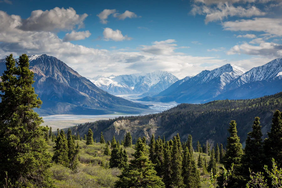
The Matanuska Valley opens between the Talkeetna and Chugach mountains, with farm country, mining history and the Knik Glacier.
Anchorage & Mat-Su
Overview
The Matanuska Valley opens between the Talkeetna and Chugach mountains, with farm country, mining history and the Knik Glacier.
Explore
The Valley mixes gold mining history, Colony farms and glacier adventures.
Cultural site
Downtown Palmer and Valley farms built by the 1935 New Deal colony of 203 Midwestern families.
Cultural site
Nonprofit Colony-era farm outside Palmer with a musk ox herd and 45-minute guided walking tours.
Cultural site
Family farm on Bodenburg Loop near Palmer where visitors go into the herd to meet and feed reindeer.

Cultural site
Late-summer fair in Palmer, known for giant vegetable exhibits, held since 1936.
Museum
Wasilla museum of aircraft, vehicles, snowmobiles and farm machinery near the Wasilla Airport.
Museum
Downtown Palmer museum and visitor center telling the story of the Valley, the Colony and local art.
Museum
Restored 1935 colony farmhouse in Palmer, run by the Palmer Historical Society.
Glacier
One of Southcentral Alaska's largest glaciers, over 25 miles long, at the head of the Knik River 50 miles east of Anchorage.

Glacier
A 27-mile valley glacier at Glenn Highway Mile 101, the largest glacier reachable by car in the United States.

Gold mine
Preserved 1930s and 1940s gold mining camp high in Hatcher Pass, with guided tours and gold panning.

Native village
Ahtna and Dena'ina village on the upper Matanuska River along the Glenn Highway, home of the Chickaloon Village Traditional Council.
Native village
Tribe governing on the traditional lands of the Dena'ina Athabascan people in the Knik and Wasilla area.

Viewpoint
28,800-acre wetland refuge at the head of Knik Arm where tens of thousands of migrating birds stop each spring.

Viewpoint
Alpine tarn at the 3,886-foot top of Hatcher Pass, with paragliders, August blueberries and summer-only road access.

Viewpoint
Mountain playground 20 minutes from Palmer: alpine trails, mining history, berry picking and big winter terrain.
Explore
The local skyline shapes weather and access.

Mountain
The 6,398-foot Chugach peak that towers over the Knik River nine miles south of Palmer.
Mountain
Prominent Chugach summit 7.5 miles east of Palmer, reached by one of the steepest trails in the area.
Mountain
The 3,720-foot mountain just east of Palmer, a favorite steep workout with views of two river valleys.
Mountain
Talkeetna Mountains summit northwest of Palmer at the edge of Hatcher Pass.
Mountain
An 880-foot rocky knob rising from the farm country of Butte between the Matanuska and Knik rivers.
Explore
Protected lands have different access, camping and activity rules.
state park
Land manager: Alaska State Parks
Explore
The Valley has short family hikes, steep peak climbs and alpine trails in Hatcher Pass.
Trail
Short family hike from the Independence Mine parking area to an alpine lake.
0.9 mi
Trail
Hatcher Pass classic: an old mining road, a boulder field and two alpine lakes, about 4.3 miles one way.
4.3 mi
Trail
Gentle valley trail up the Little Susitna River toward the Mint Glacier, 7.8 miles one way from Mile 14 of Hatcher Pass Road.
7.8 mi
Trail
Short climb from Summit Lake to a small cirque lake, continuing as a narrow ridge route to Hatch Peak.
1.1 mi
Trail
Steep Palmer landmark climb: about 3,000 feet in under two miles to a 3,720-foot summit.
2.0 mi
Trail
Gentler 3-mile switchback alternative up Lazy Mountain that rejoins the main trail higher up.
3.0 mi
Trail
The Valley's big climb: about 5,670 feet of gain in just over 4 miles to the rocky summit east of Palmer.
4.0 mi
Trail
The borough's most popular hike: a short climb with stairs to a knob overlooking Knik Glacier and Pioneer Peak.
Trail
Big-day ridge climb on the shoulder of Pioneer Peak: more than 5,000 feet in 4.5 miles to the ridge top.
4.5 mi
Trail
Steep climb from the Government Peak Recreation Area to views of Knik Arm, Knik Glacier and the Talkeetna Mountains.
3.5 mi
Trail
About 33 miles of trails on glacial ridges between Palmer and Wasilla, for biking, hiking, riding and skiing.
Trail
Mostly level all-season trail on an old railroad bed along the Matanuska River east of Palmer.
Trail
Historic multi-use trail from the Jim Creek parking area through the Knik River Public Use Area.
Trail
Easy 1-mile gravel loop around a lake in the Palmer Hay Flats, with a 35-foot viewing tower.
1.0 mi

Trail
Short forest walk from the Matanuska Glacier State Recreation Site to glacier viewing platforms.
Shelter / lean-to
Mountaineering Club of Alaska backcountry hut in the Hatcher Pass mountains, first come, first served.
Shelter / lean-to
Mountaineering Club of Alaska backcountry hut in the Hatcher Pass mountains, first come, first served.
Shelter / lean-to
Mountaineering Club of Alaska backcountry hut in the Hatcher Pass mountains, first come, first served.
Explore
Valley fishing means stocked lakes all summer and weekend-only coho fisheries in late summer.

Fishing spot
The Valley's latest coho run, from late July to freeze-up, in the Knik River Public Use Area.
Fishing spot
Stocked 362-acre lake between Palmer and Wasilla with rainbow trout, Arctic char, grayling and king salmon.
Fishing spot
Stocked lake in Matanuska Lakes State Recreation Area with accessible fishing docks.
Fishing spot
Stocked lake beside Matanuska Lakes State Recreation Area with rainbow trout and Arctic grayling.

Fishing spot
Deep roadside lake in the upper Matanuska Valley with stocked rainbow trout and Arctic char, plus burbot and lake trout.
Fishing spot
Tidal coho fishery on the Palmer Hay Flats off Hayfield Road, open weekends only.
Fishing spot
Weekend-only coho fishery reached from the Rabbit Slough access on the Palmer Hay Flats.

River
The 75-mile glacial river that carves the Matanuska Valley and flows to Knik Arm.
River
A 25-mile braided glacial river from Knik Glacier to Knik Arm, through the Knik River Public Use Area.
River
Clear river that starts at the Mint Glacier in Hatcher Pass and runs past Government Peak toward Cook Inlet.
Current ADF&G sport-fishing regulations and emergency orders
Explore
Palmer, Wasilla and Hatcher Pass are in Game Management Unit 14A, with tight weapon limits near town.
Seasons, permits and land restrictions change. Check current Alaska Department of Fish and Game regulations before planning a hunt.
Explore
Moose are everywhere in the Valley, and the Palmer Hay Flats are one of the best spring birding spots in Southcentral Alaska.
Common in Ketchikan; Prince of Wales, Mitkof and the mainland. Glacier bears, a rare blue-gray phase, live near Yakutat and Glacier Bay.
ABC islands, the mainland and Yakutat; in Ketchikan area on the mainland incl. Misty Fiords and Hyder.
Mainland and Baranof.
Everywhere; thousands gather on the Chilkat River in late fall (Oct–Nov).
Along the mainland rivers.
Explore
A four-wheel-drive vehicle does not create a right to drive off-road.
Hatcher Pass summit road is seasonal gravel; check opening and rental terms.
Conditions: Verify seasonal openings, washouts and land permissions.
Vehicle: Check rental exclusions; do not enter uncertain water crossings.
Content coming soon
Explore
Water trips require cold-water equipment and a realistic evacuation plan.
Matanuska River guided rafting; glacial water and technical sections
Difficulty: Reach- and weather-dependent; obtain local advice
Season: Generally summer; verify water levels, ice and operator schedules
Content coming soon
Explore
State, borough and lodge-run campgrounds line the Glenn Highway and Hatcher Pass Road.
Campground
Small first-come state campground on the Little Susitna River at Mile 11 of Hatcher Pass Road; 8 sites, $15.
Campground
Ten campsites at the busy Gold Mint Trailhead, Mile 13.7 Hatcher Pass Road.
Campground
Lakeside state campground between Palmer and Wasilla with 24 sites, a boat launch and stocked-lake fishing.
Campground
State campground on stocked lakes west of Palmer at Glenn Highway Mile 36.4, with trails into the Matanuska Greenbelt.
Campground
Small state campground at Glenn Highway Mile 101 with a forest trail to glacier viewing platforms.
Campground
Year-round borough campground at the edge of the Knik River Public Use Area: 26 sites, popular with anglers and ATV riders.
Campground
Riverside state campground beneath King Mountain at Glenn Highway Mile 76, with 22 sites.
Campground
Borough campground at Mile 17 Old Glenn Highway in Palmer: 87 spaces, hookups, showers and river trails.
Public-use cabin
Road-accessible log cabin at the Matanuska Glacier recreation site; sleeps 4, booked through Long Rifle Lodge.
Shelter / lean-to
Mountaineering Club of Alaska backcountry hut in the Hatcher Pass mountains, first come, first served.
Shelter / lean-to
Mountaineering Club of Alaska backcountry hut in the Hatcher Pass mountains, first come, first served.
Shelter / lean-to
Mountaineering Club of Alaska backcountry hut in the Hatcher Pass mountains, first come, first served.
Explore
Local operators and cultural institutions offer different ways to explore.
Operator
Glenn Highway lodge near Mile 102 that manages the state campground and cabin at Matanuska Glacier State Recreation Site.
Operator
Park concessionaire that takes reservations for King Mountain State Recreation Site.
Operator
Palmer outfitter running trips to the face of Knik Glacier by jet boat and large off-road truck, May 15 to September 15.
Operator
Tour company that manages Independence Mine State Historical Park, with 45-minute guided walking tours.
Operator
Rustic lodge above treeline at about 3,000 feet near Independence Mine, with dry cabins.
Operator
Matanuska Glacier guide service in Glacier View offering glacier treks, ice climbing and helicopter tours since 1999.
Explore
The Glenn Highway and Parks Highway bring most visitors from Anchorage in about an hour.
Airport
City-owned airport a mile southeast of downtown Palmer, with a 6,008-foot main runway and 24-hour fuel.
Airport
City-owned public airport 3.5 miles west of downtown Wasilla, with a 3,700-foot paved runway.
Rail station
Unstaffed Alaska Railroad stop at 1105 East Depot Road; boarding passes come from the conductor.
Gallery

Anchorage & Mat-Su

Alaska's largest city meets the Chugach Mountains, with alpine trails just outside town and tidal flats along Cook Inlet.

Talkeetna is a river town and aviation base for Denali, where the Talkeetna and Chulitna rivers join the Susitna.

Lake Louise is a big, road-accessible lake system at the end of Lake Louise Road, reached across the high Glenn Highway country past Sheep Mountain and Eureka Summit.