

Native village
Eklutna (Idlughet)
Dena'ina village at the head of Knik Arm, settled more than 800 years ago, the oldest inhabited place in the Anchorage area.
1.7 mi

River
A 25-mile braided glacial river from Knik Glacier to Knik Arm, through the Knik River Public Use Area.
The Knik River (Dena'ina: Skitnu; Ahtna: Scitna') flows about 25 miles from Knik Glacier to the head of Knik Arm, near the mouth of the Matanuska River. It is wide and shallow over gravel, sand and silt, drops about 400 feet to salt water and is considered a class I float. Windstorms lift silt off the riverbed.
Fishing · Photography · Boating
Last updated 2026-11-18

Viewpoint
28,800-acre wetland refuge at the head of Knik Arm where tens of thousands of migrating birds stop each spring.
4.7 mi

Viewpoint
Alpine tarn at the 3,886-foot top of Hatcher Pass, with paragliders, August blueberries and summer-only road access.
20.9 mi

Viewpoint
Mountain playground 20 minutes from Palmer: alpine trails, mining history, berry picking and big winter terrain.
20.9 mi
Airport
City-owned public airport 3.5 miles west of downtown Wasilla, with a 3,700-foot paved runway.
8.3 mi
Airport
City-owned airport a mile southeast of downtown Palmer, with a 6,008-foot main runway and 24-hour fuel.
13.6 mi
Airport
City-owned general aviation airport a mile east of downtown, Anchorage's first airport (1930).
23.0 mi
Fishing spot
Stocked lake in Matanuska Lakes State Recreation Area with accessible fishing docks.
8.3 mi
Fishing spot
Stocked lake beside Matanuska Lakes State Recreation Area with rainbow trout and Arctic grayling.
9.0 mi
Fishing spot
Stocked 362-acre lake between Palmer and Wasilla with rainbow trout, Arctic char, grayling and king salmon.
10.4 mi

Fishing spot
Downtown king and coho salmon fishery beside the Port of Anchorage, the area's most popular stream fishery.
23.5 mi
Campground
State campground on stocked lakes west of Palmer at Glenn Highway Mile 36.4, with trails into the Matanuska Greenbelt.
8.3 mi
Campground
Lakeside state campground between Palmer and Wasilla with 24 sites, a boat launch and stocked-lake fishing.
10.4 mi
Public-use cabin
Walk-in cabin at Eklutna Lake, just south of the Dolly Varden Cabin; sleeps 8, $100 a night.
9.8 mi
Public-use cabin
Drive-up cabin at Eagle River Campground; sleeps 6, $100 a night.
12.6 mi
Public-use cabin
Drive-up cabin at Eagle River Campground; sleeps 6, $100 a night.
12.6 mi
Public-use cabin
Small drive-up cabin at Eagle River Campground; sleeps 4, $100 a night.
12.7 mi
Public-use cabin
Cabin at the mouth of Yuditnu Creek, 3 miles up the Eklutna Lakeside Trail; sleeps 8, $100 a night.
12.7 mi
Public-use cabin
Paddle-in cabin on the southwest shore of Eklutna Lake, 3.75 miles from the put-in; sleeps 8, $100 a night.
13.6 mi
Public-use cabin
Multi-party hut at Mile 12 of the Eklutna Lakeside Trail; sleeps 13.
18.8 mi
Public-use cabin
New log cabin by Baines Pond, near Cabin #2 on Lynx Lake; sleeps 6.
24.1 mi
Public-use cabin
New log cabin 300 feet from Lynx Lake, 200 feet from Cabin #3; sleeps 6.
24.1 mi
Public-use cabin
Tiny canoe-access cabin on Lynx Lake with a view of Denali and Mount Foraker; sleeps 4.
24.2 mi
Trail
About 33 miles of trails on glacial ridges between Palmer and Wasilla, for biking, hiking, riding and skiing.
11.0 mi
Trail
The borough's most popular hike: a short climb with stairs to a knob overlooking Knik Glacier and Pioneer Peak.
12.9 mi
Trail
Mostly level all-season trail on an old railroad bed along the Matanuska River east of Palmer.
14.0 mi
Trail
Big-day ridge climb on the shoulder of Pioneer Peak: more than 5,000 feet in 4.5 miles to the ridge top.
15.9 mi
Trail
The Valley's big climb: about 5,670 feet of gain in just over 4 miles to the rocky summit east of Palmer.
16.1 mi
Trail
Gentler 3-mile switchback alternative up Lazy Mountain that rejoins the main trail higher up.
16.2 mi
Trail
Steep Palmer landmark climb: about 3,000 feet in under two miles to a 3,720-foot summit.
16.2 mi
Trail
Steep climb from the Government Peak Recreation Area to views of Knik Arm, Knik Glacier and the Talkeetna Mountains.
16.8 mi
Trail
Short climb from Summit Lake to a small cirque lake, continuing as a narrow ridge route to Hatch Peak.
20.9 mi
Trail
Short family hike from the Independence Mine parking area to an alpine lake.
22.5 mi

Cultural site
Late-summer fair in Palmer, known for giant vegetable exhibits, held since 1936.
11.9 mi

Cultural site
Downtown Palmer and Valley farms built by the 1935 New Deal colony of 203 Midwestern families.
13.2 mi
Cultural site
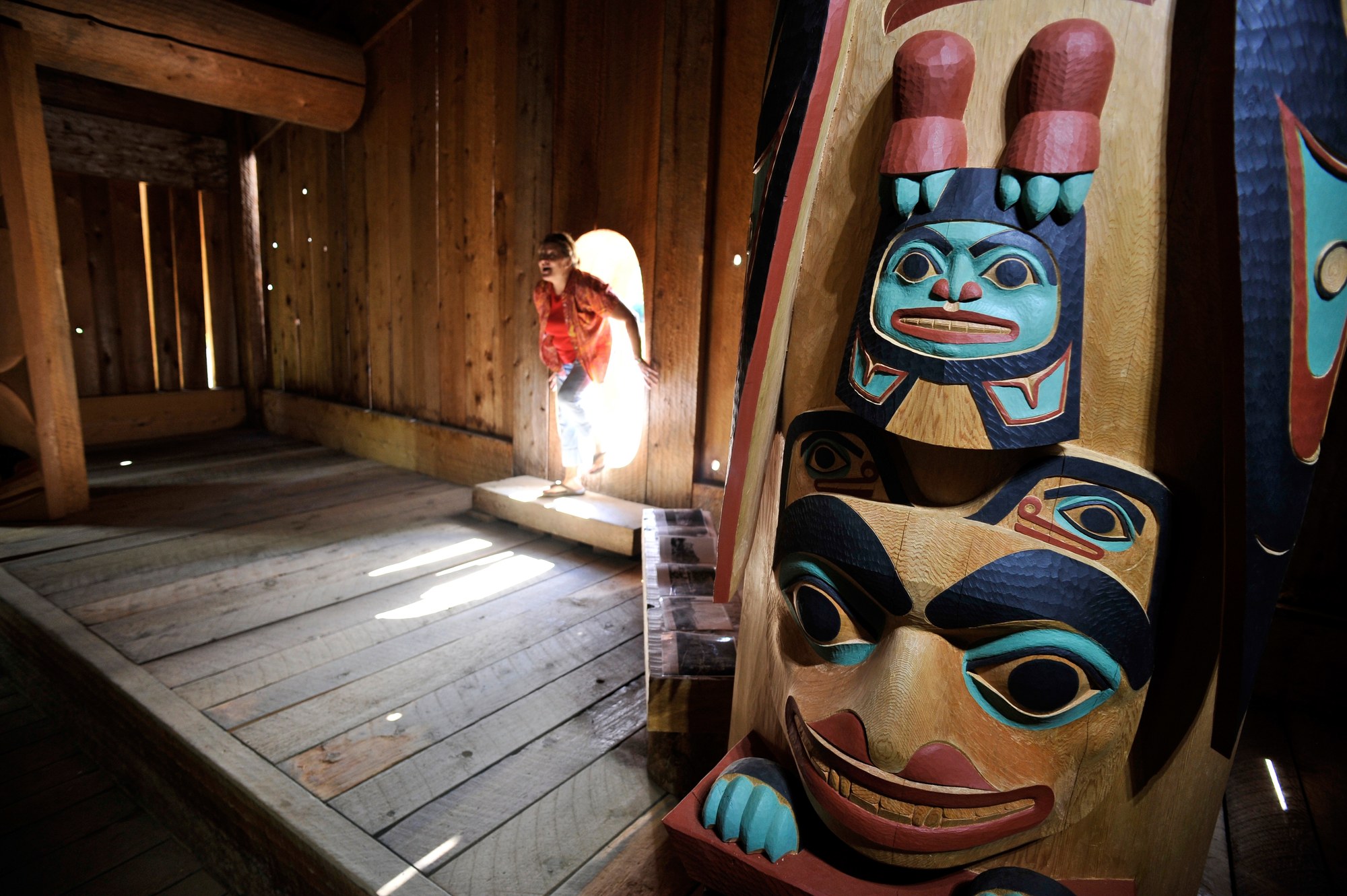
Statewide Alaska Native cultural center with dance, games, a Hall of Cultures and six village sites around a lake.
19.6 mi
Mountain
The 6,398-foot Chugach peak that towers over the Knik River nine miles south of Palmer.
12.4 mi
Mountain
An 880-foot rocky knob rising from the farm country of Butte between the Matanuska and Knik rivers.
12.9 mi
Mountain
The 3,720-foot mountain just east of Palmer, a favorite steep workout with views of two river valleys.
16.0 mi
Mountain
7,522-foot peak above the head of Eklutna Lake, a demanding trail-less scramble.
18.3 mi
Mountain
Talkeetna Mountains summit northwest of Palmer at the edge of Hatcher Pass.
18.5 mi
Mountain
Prominent Chugach summit 7.5 miles east of Palmer, reached by one of the steepest trails in the area.
19.5 mi
Mountain
8,005-foot high point of Chugach State Park and the Municipality of Anchorage, rarely climbed.
21.1 mi


